Temescal
The Temescal Canyon trail loop is a hike through rugged, chapparel covered terrain in the Santa Monica mountains that sits just east of Pacific Palisades just off Sunset Blvd - though it is worlds apart from the infamous Strip a few miles down the road. It's a popular hike and very accessible to city dwellers (minimal traffic), but certainly not the easiest hike in the local area. If you lived close by, you probably wouldn't need to invest in a gym membership - you could just hike temescal 3 times a week instead.
It begins at the parking lot which is supervised by the "Iron Park Ranger" which is a little postbox that demands $6 in a envelope for parking. And trust me, if you don't pay that fee the human park ranger will give you a $30 ticket.
You will need to bring at least 2 liters of water with you -- if you don't have any, don't even think about doing this trail. There is no little shop at the top, and the one at the parking lot never seems to be open. And you must leave your dog at home if you want to do the loop.
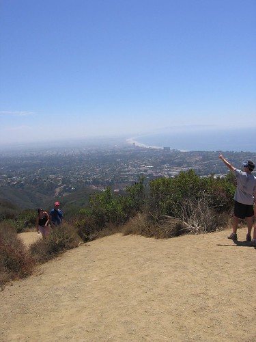
If you want an excuse to reward yourself with a burger afterwards and don't want to have to go to the gym for a few days, approach this trail from the west side. If you want an easier hike go east. The initial approach from the west is generally unremarkable but instantly strenuous -- once you get about halfway up (about 20 minutes) which generally coincides with the feeling that you can't go one step further, take the time to catch your breath and reward yourself with a first glimpse of the view - on a clear day, you can see Catalina Island, Long Beach, and the entire LA b
 asin. Now you have your incentive to soldier on - I usually find this is also the point when some smug fitness freak sprints pass you Carl Lewis-style uphill, probably carrying handweights and boasting less than 10% body fat. As you head towards the top, you will probably think you have reached the top at least 5 times before you actually do - remind yourself that the view will be totally worth it. It will.
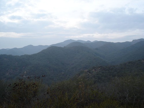
The view to the west is one of how the other half lives -- sprawling estates with tennis courts and swimming pools. I have no idea who lives there but one day, when I break down and buy a star map I'm going to come up here with some binoculars to do some, uh, birdwatching to see if I can spot the crested Brangelina or the red-winged Spielberg. If you haven't completely spent yourself, trudge further up the trail along the ridge to Skull Rock for an better view -- it's hard to imagine that you are standing in the middle of the second biggest city in the United
 States because it feels like the middle of nowhere.
The descent on the east side is very beautiful. About halfway down - after no doubt encountering a few hikers huffing and puffing there way up - you arrive at the waterfalls, which is probably the most pleasant part of the trail. The rest of the trail is very rocky and quite steep -- I fell over twice. It's also not very clearly marked - so I found myself wandering into a clearing where a posh wedding was being held. At the end of the loop, the trail ends where it begins - in the parking lot. Which is followed by a trip to Swingers in Santa Monica for my burger reward, possibly negating the fitness benefits of undertaking the Temescal challenge but I don't really care since I will feel the affect of it for at least a few days in my calves and arse.
posted by Rob1n at 4:18 PM
![]()

0 Comments:
Post a Comment
<< Home